Roman Rural Landscapes in Noricum
Archaeological Studies on Roman Settlements in the Hinterland of Northern Noricum
PhD project at the Faculty of Historical and Cultural Studies
PhD project
Roman Rural Landscapes in Noricum
The PhD project deals with archaeological settlement activities in a precisely defined study area in the northern (today Lower Austrian) hinterland of the former Roman province of Noricum.
- Funding: University of Vienna
- Lifetime: July 20, 2018 – 2021 (scheduled date)
News
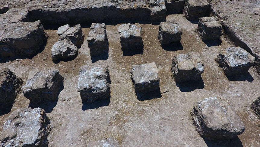

![Der Fundplatz Oberndorf a. d. Melk innerhalb der AOSI: Am linken Flussufer der Melk wurde im Zuge geophysikalischer Prospektionen (rechts oben: Daten und Interpretation Magnetik, rechts unten: Daten und Interpretation Radar) archäologische Strukturen erfasst, die als römische villa rustica (links) interpretiert werden können. (archäologische Daten und Interpretation: Volker Lindinger, ARDIG 2016 [Alle Rechte vorbehalten] | Grundkarte: basemap.at | DEM, Orte und Gewässerstrecken: Land Niederösterreich [CC BY 3.0 AT] | Dominik Hagmann | Version 1.0.0 | 2019-01-03 | CC BY 4.0) DOI: 10.25365/phaidra.98](/fileadmin/_processed_/csm_OBERNDORF_1500PX_4103e36a21.jpg)
Map 1
The Area of Interest (AOI) and Area of Special Interest (AOSI) within today's Lower Austrian section of Noricum (basemap.at Grau | Dominik Hagmann | Version 1.0.0 | 2019-01-10 | CC BY 4.0)
Concept
From 15 BC to 488 AD Noricum formed part of the Roman Empire. While particular regions of this province (e.g. the limes zone) have been in the focus of archaeological research for decades, in-depth analyses of other areas (e.g. the rural hinterland) remain absent often. This state of research applies especially to the section of the former ancient Roman Province in what is now the federal state of Lower Austria.
To improve the relatively poor state of research, the archaeological settlement activities in the hinterland of the limes zone and of the ancient Roman municipium of Aelium Cetium/St. Pölten in Northern Noricum are invastigated and re-evaluated by Dominik Hagmann in course of his PhD project 'Roman Rural Landscapes in Noricum: Archaeological Studies on Roman Settlements in the Hinterland of Northern Noricum' in a well-defined study area.
Project design
The project is meant to be a critical study in landscape archaeology and aims to shed new light on rural settlements in the study area that have so far been neglected in archaeological research for various reasons.
The project pursues an inclusive approach: all available archaeological sources should be taken into account within the ‘area of interest’ (AOI). A further ‘area of special interest’ (AOSI) is defined within the AOI and is used for studies in settlement archaeology at two exemplary sites (villae rusticae of Oberndorf a. D. Melk in the Melk-valley and Petzenkirchen in the Erlauf-valley). While open geodata is used to analyze the environment mainly, unstructured and heterogeneous archaeological data sets of varying extent are the project’s core.
While the project's temporal focus lies on the periods of Roman antiquity also precedent and subsequent periods like the late Latène period (La-Tène D, approx. 150 BC to 15 BC) and the early Middle Ages (post 488 AD) should be taken into account in order to evaluate the spatial, temporal, and material transformation of the AOI.